
Filter by
SubjectRequired
LanguageRequired
The language used throughout the course, in both instruction and assessments.
Learning ProductRequired
LevelRequired
DurationRequired
SkillsRequired
SubtitlesRequired
EducatorRequired
Results for "geographic information systems (gis)"
 Status: NewStatus: Free
Coursera Instructor Network
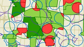
Skills you'll gain: Geographic Information Systems, Geospatial Information and Technology, Geospatial Mapping, Spatial Data Analysis, Global Positioning Systems, Data-Driven Decision-Making

Skills you'll gain: Incident Response, Security Controls, Cryptography, Malware Protection, Key Management, Vulnerability Assessments, Risk Management, Continuous Monitoring, Public Key Infrastructure, Endpoint Security, Disaster Recovery, Computer Security Incident Management, OSI Models, Network Security, Encryption, Authentications, Mobile Security, Operational Risk, Security Awareness, Authorization (Computing)
 Status: Free
The Hong Kong University of Science and Technology
Skills you'll gain: Systems Development Life Cycle, Information Assurance, Internal Controls, Information Systems Security, Compliance Auditing, Risk Management, Security Controls, Change Management, System Implementation, System Monitoring, Risk Analysis, Risk Mitigation, Software Development
University of Toronto
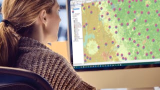
Skills you'll gain: Spatial Analysis, Geographic Information Systems, Geospatial Mapping, ArcGIS, GIS Software, Data Manipulation, Data Synthesis, Data Visualization, Data Compilation, Data Processing, Data Mapping, Data Storytelling, Metadata Management, Data Integration, Data Management
 Status: Free
École Polytechnique Fédérale de Lausanne
Skills you'll gain: Geographic Information Systems, Data Modeling, GIS Software, SQL, Database Design, Spatial Data Analysis, Spatial Analysis, Query Languages, Relational Databases, Land Management, Data Capture, Data Storage, Data Management
University of California, Davis
Skills you'll gain: ArcGIS, Data Storytelling, GIS Software, Spatial Data Analysis, Data Presentation, Geographic Information Systems, Spatial Analysis, Geospatial Mapping, Geospatial Information and Technology, Heat Maps, Data Visualization Software, Network Analysis, Data Manipulation

Skills you'll gain: Cyber Threat Hunting, Incident Response, IT Service Management, Identity and Access Management, Cloud Computing, Governance Risk Management and Compliance, Information Technology Infrastructure Library, Endpoint Security, Malware Protection, Penetration Testing, Linux, Computer Security Incident Management, Database Management, Network Security, Networking Hardware, TCP/IP, Cybersecurity, Cyber Threat Intelligence, Interviewing Skills, Cyber Security Assessment

Skills you'll gain: Embedded Software, C (Programming Language), Embedded Systems, Debugging, Peripheral Devices, Integrated Development Environments, Computer Programming Tools, Development Environment, System Programming, Program Development, Hardware Architecture, Data Structures, Microarchitecture, Performance Tuning, Computer Architecture, C++ (Programming Language), Data Storage, Computational Logic, Computer Hardware, Computer Programming

L&T EduTech
Skills you'll gain: Geospatial Information and Technology, Spatial Analysis, GIS Software, Spatial Data Analysis, Geographic Information Systems, Geospatial Mapping, Database Management, Database Management Systems, Construction Management, ArcGIS, Relational Databases, Visualization (Computer Graphics), Heat Maps, Civil and Architectural Engineering, Global Positioning Systems, Decision Support Systems, Building Information Modeling, As-Built Drawings, Survey Creation, AutoCAD Civil 3D
 Status: New AI skills
Google
Skills you'll gain: Storyboarding, Wireframing, UI/UX Research, Responsive Web Design, User Experience Design, Design Thinking, User Research, Information Architecture, Figma (Design Software), Usability Testing, User Story, Web Design, Design Reviews, Usability, Presentations, Design Research, Persona (User Experience), Ideation, User Centered Design, Mockups

Skills you'll gain: IT Service Management, Cloud Computing, Governance Risk Management and Compliance, Information Technology Infrastructure Library, Malware Protection, Identity and Access Management, Linux, Incident Response, Networking Hardware, TCP/IP, Cybersecurity, Network Security, Network Protocols, Threat Modeling, Linux Servers, Cloud Security, Operating Systems, Endpoint Detection and Response, NIST 800-53, Regulatory Compliance
 Status: New AI skills
Google
Skills you'll gain: Network Security, Incident Response, Computer Security Incident Management, Hardening, Stakeholder Communications, Intrusion Detection and Prevention, Security Management, Threat Management, Cybersecurity, Network Protocols, Network Architecture, Event Monitoring, Cyber Risk, TCP/IP, Threat Detection, Operating Systems, File Systems, Security Controls, Debugging, Python Programming
Searches related to geographic information systems (gis)
In summary, here are 10 of our most popular geographic information systems (gis) courses
- GIS Mastery: Spatial Data, Remote Sensing, Decision Support: Coursera Instructor Network
- ISC2 Systems Security Certified Practitioner (SSCP): ISC2
- Information Systems Auditing, Controls and Assurance: The Hong Kong University of Science and Technology
- GIS, Mapping, and Spatial Analysis Capstone: University of Toronto
- Systèmes d’Information Géographique - Partie 1: École Polytechnique Fédérale de Lausanne
- Geospatial Analysis with ArcGIS : University of California, Davis
- IBM Cybersecurity Analyst: IBM
- Embedded Software Development with C: EDUCBA
- Geospatial Techniques for Engineers: L&T EduTech
- Google UX Design: Google


